Update on Noto-Hanto earthquake, Japan 2023: Intensity change map
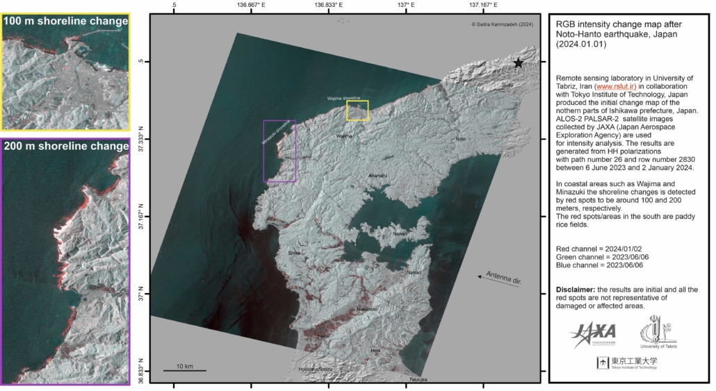
Remote sensing laboratory in University of Tabriz, Iran (www.rslut.ir) in collaboration with Tokyo Institute of Technology, Japan produced the initial change map of the northern parts of Ishikawa prefecture, Japan. ALOS-2 PALSAR-2 satellite images collected by JAXA (Japan Aerospace Exploration Agency) are used for intensity analysis. The results are generated from HH polarizations with path number 26 and row number 2830 between 6 June 2023 and 2 January 2024.
In coastal areas such as Wajima and Minazuki the shoreline changes are detected by red spots to be around 100 and 200 meters, respectively. The red spots/areas in the south are paddy
rice fields.
Red channel = 2024/01/02
Green channel = 2023/06/06
Blue channel = 2023/06/06
Disclaimer: the results are initial and all the red spots are not representative of damaged or affected areas.


