Southern California (Palisades) Fire Map

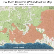
Multi-temporal SAR interferometric analysis of Sentinel-1 images from descending orbits was performed to generate change detection map. The red polygons indicate possible burned areas.

Multi-temporal SAR interferometric analysis of Sentinel-1 images from descending orbits was performed to generate change detection map. The red polygons indicate possible burned areas.
